Real-time Monitoring
Map Positioning
Flood Control Early Warning
Intelligent Linkage
Emergency Response
Data Analysis
Home
Product

Industries

Solution
About Us

Service Support
Contact Us
Real-time Monitoring
Map Positioning
Flood Control Early Warning
Intelligent Linkage
Emergency Response
Data Analysis
Switch


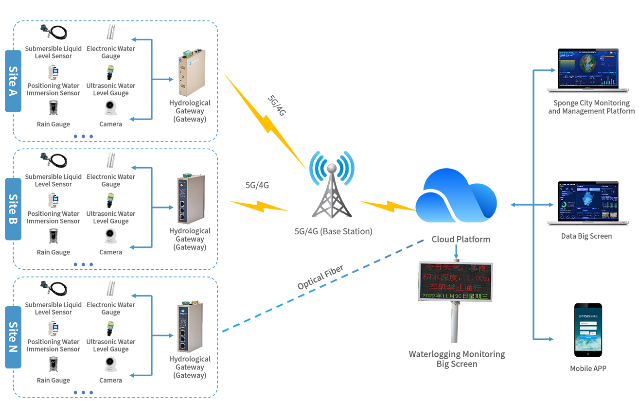
Real-time monitor parameters such as water level, liquid level height, rainfall, and flow velocity. The monitoring frequency can be set for 24/7 uninterrupted operation. Urban waterlogging and water accumulation status as well as video images can be monitored in real time through mobile terminals, PC terminals, and data dashboards.

Supports GIS geographic location display to centrally monitor real-time water level data and water accumulation conditions at various waterlogging points in the city. On-site location information, basic information, and real-time status can be displayed through manual switching and automatic query, facilitating overall management and layout.

Supports flood control early warnings for heavy rains, water accumulation, etc. The system automatically alarms when water level is too high or equipment is abnormal. Warning information can be pushed to responsible persons via SMS, email, WeChat, etc., enabling timely measures to solve problems.

Preset corresponding waterlogging and flood control parameters to predict the arrival of waterlogging in advance. Link with LEDs to release real-time information to prevent personnel and vehicles from entering deep-water sections. Meanwhile, link and control on-site drainage equipment for timely drainage to avoid and delay urban waterlogging.

Establish a linkage mechanism with urban emergency management, transportation, fire protection and other departments. Quickly formulate emergency plans to guide emergency teams in rapid response, conduct timely drainage operations, traffic diversion and personnel evacuation, reduce the impact of water accumulation, and improve emergency response capabilities.

Establish an analysis model based on historical data and real-time monitoring data to mine valuable data that is more conducive to improving the level and efficiency of drainage and flood control management, providing a scientific decision-making basis for the government and relevant departments.